Weather update: From extreme heat to flash flooding, extreme weather warning issued for millions of Aussies on both sides of the country
Australians on both sides of the country are being urged to brace for extreme weather conditions as forecasts warn of a turbulent weekend ahead.
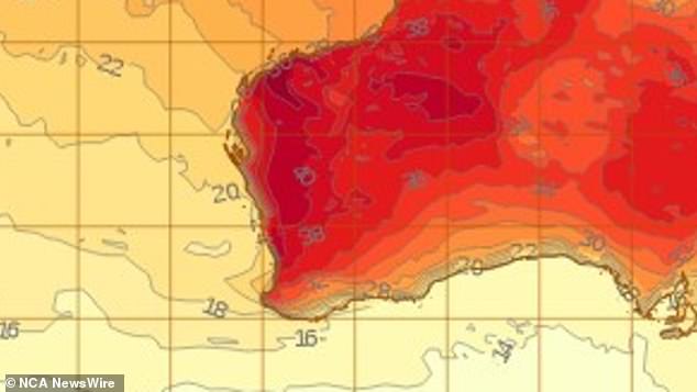
A heatwave warning has been issued for the south-west of Western Australia, while isolated flash flooding threatens residents of the inland east coast throughout the weekend.
After a week of bushfires just north of Perth on Wednesday and Thursday, forecasts suggest persistently warm conditions and strong gusty winds will continue throughout the weekend.
Bureau of Meteorology senior meteorologist Dean Narramore said there was a low to severe heatwave threat for metropolitan Perth, with temperatures reaching highs of 39 degrees on Saturday and Sunday.
“We are looking at widespread showers and thunderstorms across Queensland, New South Wales and Victoria,” Bureau of Meteorology senior meteorologist Dean Narramore said.

After a week of bushfires just north of Perth on Wednesday and Thursday, forecasts suggest persistently warm conditions and strong winds will continue throughout the weekend
‘Very warm weekend there [Perth] with back-to-back 39 degrees,” Mr Narramore said.
He said good news is on the horizon, with a predicted “cool change” expected to happen early next week.
Temperatures in the WA city are expected to drop to the low 30s on Monday and into the mid 20s on Tuesday.
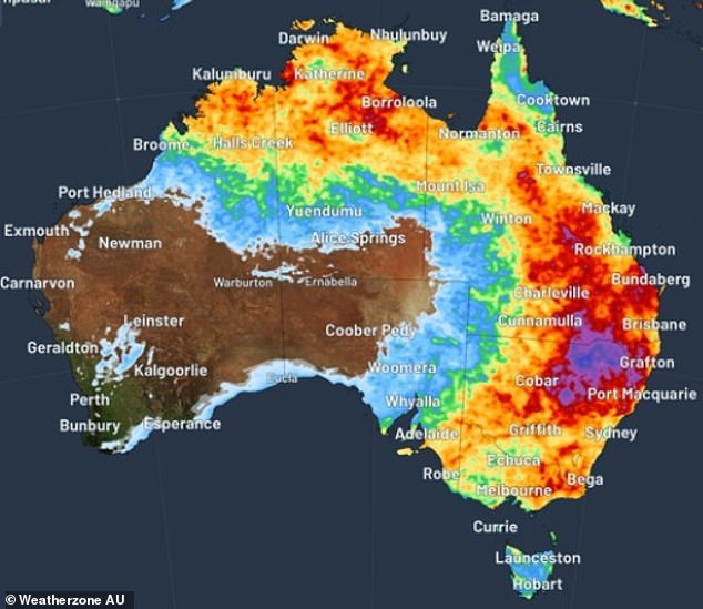
On the other side of the country, residents along the east coast have been warned of flash flooding and thunderstorms for most of the next week.
“We are looking at widespread showers and thunderstorms across Queensland, New South Wales and Victoria,” Narramore said.
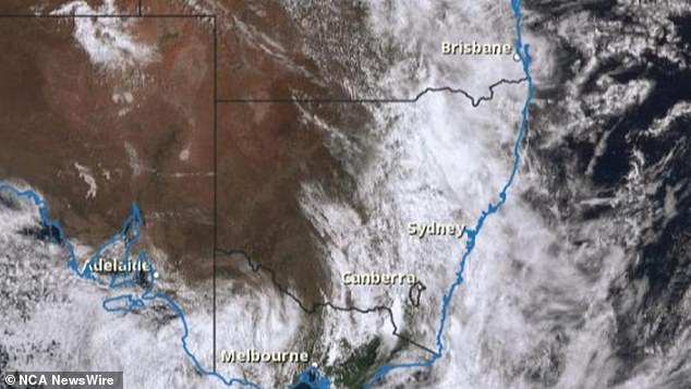
A broad lower pressure system will sweep across the east coast this weekend and winds coming from the Tasman and Coral Seas will bring moisture-laden air, bringing widespread showers and thunderstorms.

On the other side of the country, residents along the east coast have been warned of flash flooding and thunderstorms for most of next week.

A broad lower pressure system will sweep across the east coast this weekend and winds coming from the Tasman and Coral Seas will bring moisture-laden air, bringing widespread showers and thunderstorms.
Mr Narramore said inland residents should prepare for a “very active and wet week” ahead, and urged anyone traveling in high rainfall areas to keep an eye on radar and forecasts to hold.
“With these heavy falls, especially during heavy thunderstorms, we could have created isolated areas of flash flooding,” he warned.
‘Especially with the heavy thunderstorms over the weekend, next Tuesday, Wednesday and Friday.’
Thunderstorms are also expected over parts of South Australia on Sunday.
The heaviest rain forecast is likely to hit Brisbane and the Gold Coast on Tuesday, before more thunderstorms escalate over NSW and Victoria on Friday.
