The summer warning that every Australian needs to read: Astonishing map shows true scale of soaring temperatures
Summer warning every Australian should read: Stunning map shows true extent of rising temperatures
Australians are being warned that the next seven months could bring major heatwaves and bushfires to large areas of the country.
The Bureau of Meteorology said in its latest climate outlook that an El Nino weather pattern on the east coast combined with a positive Indian Ocean dipole in the west could bring extreme heat between October and April.
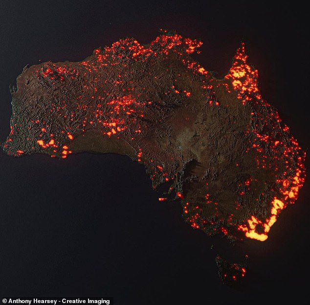
Just a few years ago Australia endured some of the most widespread bushfires on record during the 2019/2020 Black Summer bushfires, which burned an estimated 24.3 million hectares.
There has been a La Nina weather pattern that has brought increased precipitation in the years since, but the two dominant climate drivers this summer will typically result in lower precipitation and higher temperatures individually, and the phenomenon is strengthened when they occur together.

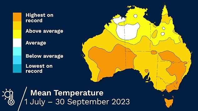
There have already been record temperatures in parts of Australia this year

The Bureau of Meteorology has predicted an extremely hot and dry summer (pictured: a composite image from NASA satellites showing where fires ravaged the country in summer 2019/2020)
Senior meteorologist Sarah Scully said the forecast showed a high chance of much of the country experiencing unusually warm temperatures until at least February 2024.
“Daytime and nighttime temperatures have an increased chance of being unusually warm from October through February,” she said.
‘Warm nights after hot days mean little relief from the heat and can lead to heat stress.’
Much of eastern and southern Australia will also be at risk of increased bushfires due to high temperatures, reduced rainfall and increased fuel loads.
“There is always a risk of dangerous and devastating bushfires in Australia at this time of year,” Ms Scully noted.
“Grass growth due to above-average rainfall in the past two to three years is contributing to an increased fire risk.”
The bushfire season got off to a worrying start this year, with 70 fires burning across NSW in August.

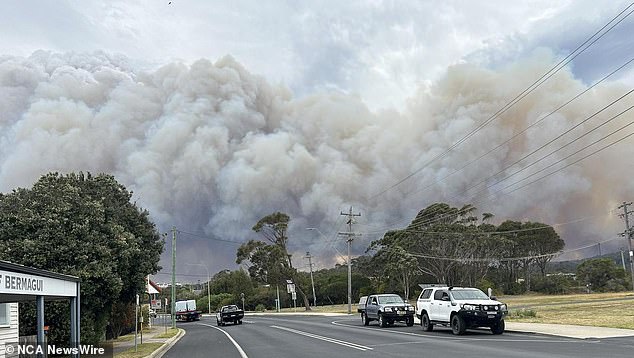
The NSW South Coast town of Bermagui and surrounding areas were told it was too late to leave on October 3. Photo: Twitter
In the intervening weeks, dangerous fires have been reported in every jurisdiction in Australia and some have forced the emergency evacuation of large communities.
However, there is a silver lining for millions of Australians in the latest BOM forecast.
According to the bureau, El Nino and positive Indian Ocean Dipole events will result in an 80 percent chance of fewer tropical cyclones.
“During El Nino, the number of tropical cyclones in the Australian region is often below average,” Ms Scully said.
However, the BOM notes that at least one tropical cyclone passes the Australian coast each season.
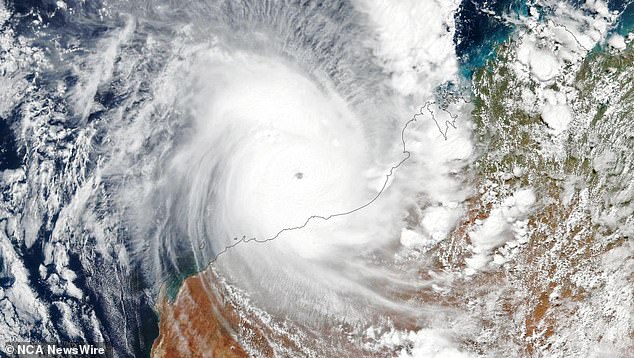
The area most likely to be affected is the northwest coast between Broome and Exmouth in Western Australia.

The Bureau of Meteorology has warned that the next seven months will bring an increased risk of severe weather. Photo: NASA/Earth Observatory
North Queensland and the High End of the Northern Territory also typically experience a large number of tropical cyclones.
Residents of these areas will get some time with the Bureau predicting that changing weather conditions will delay the start of the cyclone season.
“On average, the first tropical cyclone crosses the Australian coast in late December,” Ms Scully said.
“That could be later in El Nino years — maybe as early as mid-January.”
The bureau predicts that the start of the summer monsoon will also be pushed back by several weeks to early January.
According to the weather forecast, there will be a normal risk of severe storms in late spring and early summer.
Despite drier than usual conditions, the BOM warns that heavy rainfall may still result in localized flash flooding or river flooding.
Preparation is key, according to the Bureau, which urges Australians to stay up to date with the latest weather warnings.
The extreme weather forecast comes on the eve of Australia’s hottest winter on record.
(tagsTranslate) daily mail(s) news(s) Australia Fires
