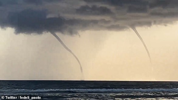
Terrifying videos show giant waterspouts lashing Italian coastline on same day as Bayesian yacht disaster as experts reveal Mediterranean ‘turned to petrol’ by wave of scorching 40 degree Celsius heatwaves
Violent storms and extreme tornadoes have ravaged Italy in recent days, killing at least one person and causing widespread destruction along the country’s southern coast.
A waterspout – a tornado over the sea – is believed to have hit the British-flagged Bayesian superyacht while it was at anchor off the coast of Sicily yesterday.
The ship’s mast snapped, sinking the £30 million boat and prompting a search for the six passengers on board, including British owner Mike Lynch. The disaster also resulted in the death of a crew member.
On the same day as the tragedy, terrifying videos of huge waterspouts churning across the Mediterranean were shared by locals and holidaymakers across southern Italy.
Tourists in seaside resorts have been faced with bad weather in recent days, with dramatic images showing beaches and city centres devastated by gale force winds.
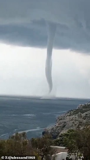
A towering waterspout was caught on camera off the coast of Salento, southern Italy
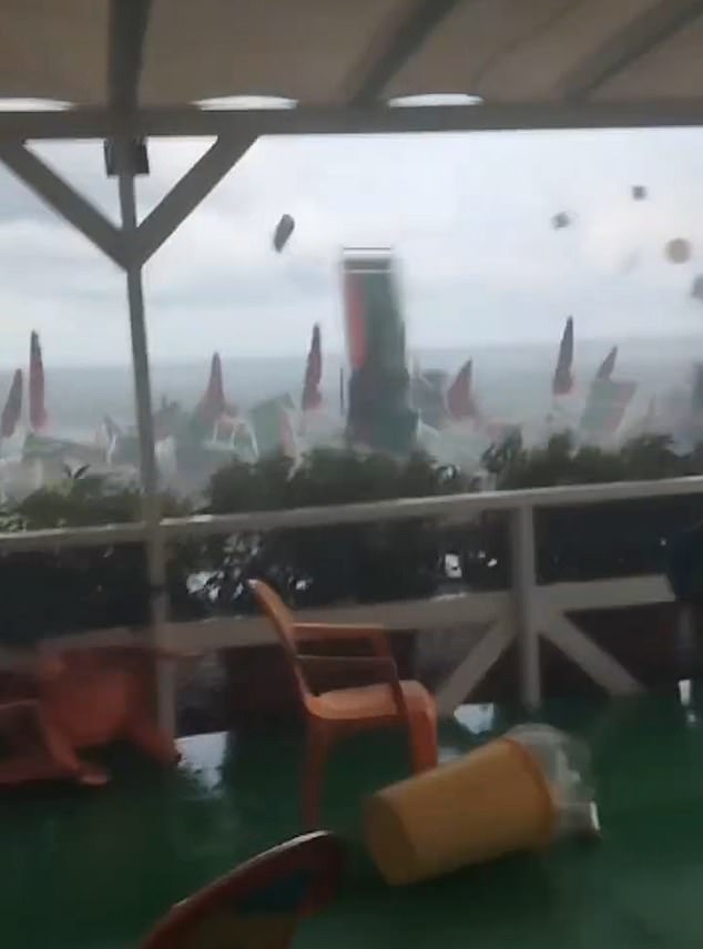
Strong winds, which locals said were the result of a tornado, caused chaos on a beach in Salerno
Storms and heavy rains have hit the country after weeks of scorching heat sent the Mediterranean Sea to record highs, raising the risk of extreme weather events, experts say.
Meteorologist Paolo Sottocorona, who is also a sailing instructor, explained how dangerous it is to be at sea in the current conditions.
“The warm sea seems pleasant, but heat is energy from a physical point of view,” he said. “The Mediterranean Sea is a petrol tank at the moment. If you throw a match in it, that is, a cold air current like the one we have today, it will explode.”
“The warmer the sea, the stronger the tornadoes,” he continued. “The most destructive tornadoes used to occur once every hundred years.
“Now we see one or more per year. Even meteorological models have trouble predicting such violent events.”
Sicily was hit by severe weather conditions on Sunday night and Monday morning, with wind and thunderstorm warnings in place for the island.
A strong wind was blowing through the coastal areas, including Porticello, where Bayesian was anchored.
“I had never seen anything like it. A tornado that lasted about ten minutes, an apocalyptic scenario,” said Giuseppe D’Agostino, the mayor of Santa Flavia, a town near Palermo.
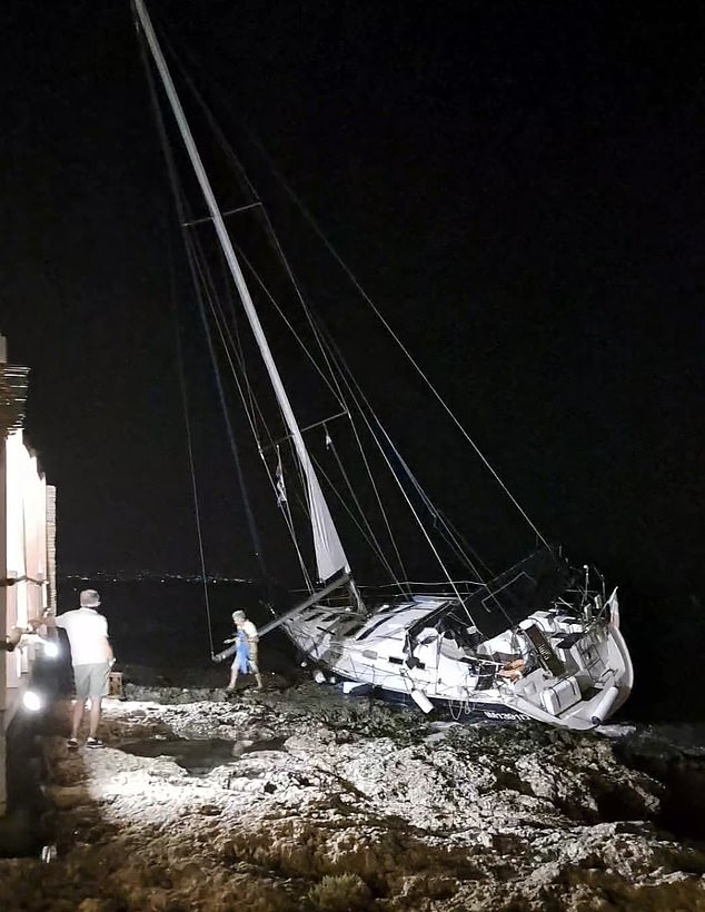
In the Gulf of Brucoli in southern Sicily, locals shared photos of a sailboat stranded on rocks after being swept away by strong winds
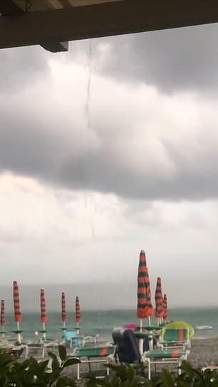
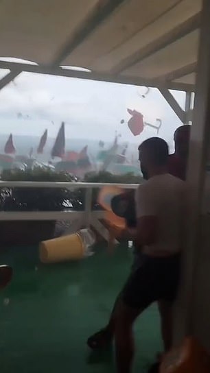
Video footage emerged yesterday of umbrellas and chairs scattered across a coastal town by what witnesses described as a tornado
“The sea surface temperature around Sicily was around 30 degrees Celsius (86 Fahrenheit), almost three degrees higher than normal,” said meteorologist Luca Mercalli.
“This creates a huge source of energy that contributes to these storms.”
He added that while it cannot be said “that this is all due to global warming”, it clearly has an “amplifying effect”.

British tech magnate Mike Lynch was aboard his yacht, the Bayesian, when it was hit by a tornado on Monday
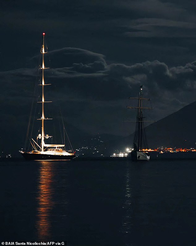
This photo shows the luxury superyacht named The Bayesian (left) off the coast of Porticello, Palermo, the night before it was hit by the storm
Security footage from around 4am yesterday shows a sudden deluge of wind and rain sweeping across the city.
The strong winds sent umbrellas, flower pots, tables and chairs flying in seconds. The local restaurant that shared the footage said: ‘In no time everything was swept away by the hurricane!’
The owners of Baia Santa Nicolicchia said they were able to reopen later in the morning once the storm had passed, but added: “We have no memory of anything like this in our area.”
In the Gulf of Brucoli in southern Sicily, locals shared photos of a sailboat that had been stranded on rocks by strong winds.
North of Sicily, in Italy’s Campania region, video footage emerged yesterday of umbrellas and chairs strewn across a coastal town by what witnesses described as a tornado.
Images show tourists seeking shelter as storm winds pick up on a beach in Santa Marina, in the province of Salerno.
Suddenly, a huge gust of wind blows umbrellas and deck chairs to where they were standing, while the person making the film runs for cover.
Although local residents reported serious damage to the building and surrounding area, miraculously no one was injured in the incident.
Images from the area – the Gulf of Policastro – shared around the same time show a waterspout threatening a motorboat below.
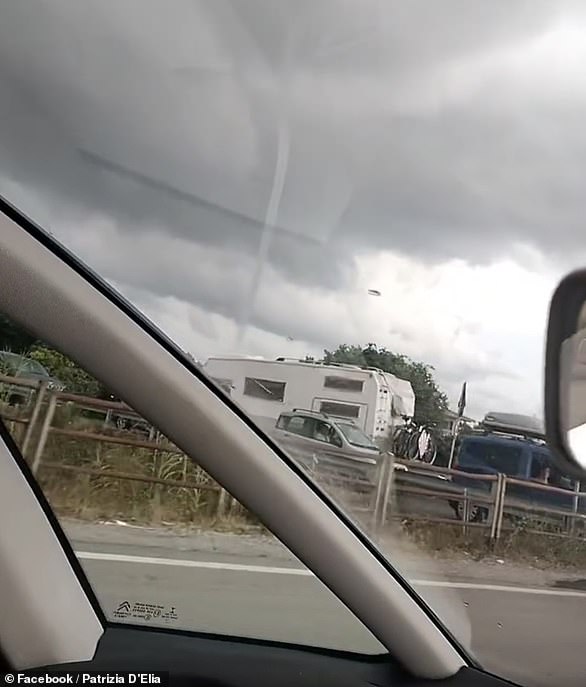
A motorist living nearby also shared footage of the extreme weather phenomenon taken from her car.
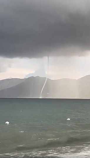
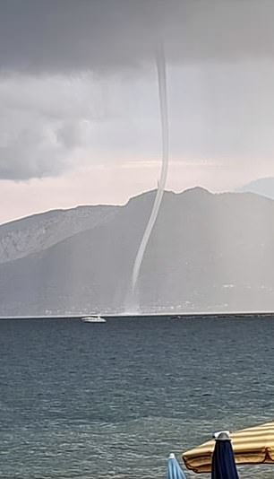
Images from the Gulf of Policastro show a waterspout threatening a motorboat below
Tornadoes have been reported along the Adriatic coast, with impressive video footage showing huge swirls of water swirling across the sea at Santa Cesarea Terme and Gagliano del Capo.
In the Apulia region, the heel of Italy’s ‘boot’, fishermen who were at sea have reportedly been recalled due to the phenomenon.
A powerful waterspout was filmed off the coast of Salento, in the far south of the region.
There are reports that people in coastal areas have been evacuated from their homes, while many people have been warned to stay off the beaches as storms approach.
Italy’s Civil Protection has issued a yellow alert for 11 areas, including Campania, Puglia, Calabria and part of Sicily, warning of more cloudbursts and thunderstorms.
Areas across the Italian peninsula have already suffered costly property damage and downed trees from the storms.
Serious flooding has also been observed in northern and central Italy in recent days.

