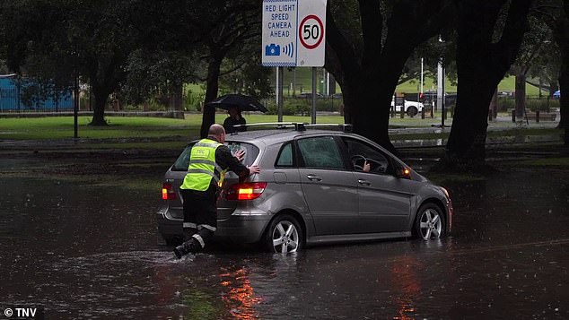
More than a month’s worth of rain pummels Sydney in less than 24 hours
- Rain fell over Sydney for over a month
- Approximately 171mm recorded at Rose Bay
After receiving more than a month of rain in less than one day, Sydneysiders can finally put away their umbrellas and enjoy the sun.
However, flood warnings remain in force around the Hunter area, with minor flooding on the Williams River and moderate flooding on the Wollombi Brook River, BOM senior meteorologist Dean Narramore said on Sunday.
Mr Narramore said dangerous surf and beach conditions would also continue into Monday in NSW’s southern and central coastal areas.
This comes after persistent moderate to heavy rainfall lashed the state in the Sydney and Hunter areas on Saturday.
Mr Narramore said the heaviest rainfall fell around Sydney on Saturday, with 171mm of rain in Rose Bay, 159mm in Little Bay and 143mm in the city itself.
After receiving more than a month of rain in less than one day, Sydneysiders can finally put away their umbrellas and enjoy the sunshine (photo: flooding at Lewisham Station in western Sydney)

Mr Narramore said the heaviest rainfall fell around Sydney on Saturday, with 171mm of rain in Rose Bay, 159mm in Little Bay and 143mm in the city itself.
“To put that in perspective, their monthly average in June is 132mm,” Narramore said.
“So many of our eastern suburbs in Sydney saw a month’s worth of rain in just 12 to 18 hours.”
Mr Narramore said the heavy rainfall was caused by a large rainstorm that had moved across the country in recent days and developed into a low-pressure system off the coast on Saturday, pushing some of the rain back onto coastal areas in Sydney. Central Coast and Hunter Districts.
“That low point is now further and further away, so we’ve seen rain and shower activity decrease in the Sydney area, while showers continue in the Hunter,” Mr Narramore said.
“But all of that should clear up by Sunday evening, making it a sunny Monday for much of NSW.”
While the rain had largely cleared in Sydney on Sunday morning, Narramore said a few “light and isolated” coastal showers could still occur.
On the other side of the country, residents have also been using their umbrellas after a strong cold front hit western WA late on Saturday.
“That brought heavy rain, damaging winds and severe thunderstorms,” Narramore said.
“We have a severe weather warning in place from Kalbarri all the way to Albany

While the rain had largely cleared in Sydney on Sunday morning, Mr Narramore said there could still be a few “light and isolated” coastal showers
“That includes places like Perth, Bunbury and extending into inland parts of the central wheat belt and the Great South.”
Mr Narramore said there had been widespread rainfall of 30 to 50mm, including 42mm in Perth and winds of more than 100km/h on Rottnest Island.
WA’s cold front is likely to continue moving inland on Sunday as conditions begin to ease along the coastal fringe and in the south-west, Mr Narramore said.
But it will still be a windy day, with showers that may include hail and localized thunder, as well as large seas and swells, especially around southwestern parts of WA.
A warning remains in place for strong to gusty winds in some coastal waters, with a sheep grazer warning for the lower western and south-western districts.
