Shock update after child was struck by lightning and left fighting for life during wild storms in southeast Queensland
A second person has been struck by lightning after wild weather hit southeast Queensland and left a 10-year-old girl fighting for her life.
Paramedics rushed a man to Gold Coast University Hospital after he was struck by lightning at a home in the city's north after 4pm on Saturday.
The man, in his 60s, is in a stable condition after being hit at Biggera Waters on the northern Gold Coast.
Emergency services said the man was alert and speaking when they arrived.
It comes after a ten-year-old girl was struck by lightning on a private property on Clarkes Road in Beerwah, on the Sunshine Coast, at around 2.30pm the same day.
A man in his 60s was struck by lightning at Biggera Waters on the northern Gold Coast on Saturday afternoon (pictured)
Emergency services took the girl to Sunshine Coast University Hospital in a critical condition, where she remains.
Residents said the storm's impact was not as severe as Friday evening's.
“It just really started raining, the wind was getting crazy,” said Caleb Woolridge, general manager of Wilson Timbers 9News.
It comes as record-breaking damaging winds, large hail and heavy rain wreaked havoc across south-east Queensland.
The Bureau of Meteorology has issued several severe weather warnings since the storms began moving across the region on Friday.
A warning at 3.20pm on Saturday warned that the council areas of Ipswich, Logan, Scenic Rim, Gold Coast, Sunshine Coast, Noosa, Brisbane City, Moreton Bay and Gympie could experience severe thunderstorms, damaging winds, hail, heavy rain and flash floods.
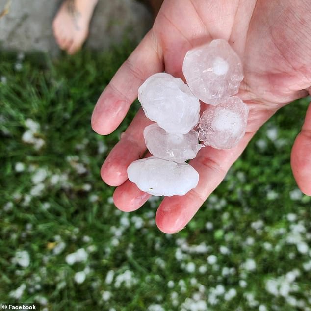
Hailstones measuring four centimeters fell over Beaudesert, west of the Gold Coast, around 4pm.
It follows Friday evening's violent storms, which caused extensive damage across the region.

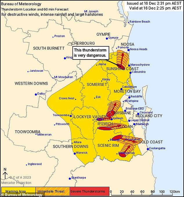
A child is in critical condition after being struck by lightning during heavy storms in south-east Queensland (pictured, a forecast of storms for Saturday)

Record-breaking damaging winds, large hail and heavy rain continue to wreak havoc across south-east Queensland
BOM senior meteorologist Shane Kennedy said the winds measured at Archerfield, south Brisbane, were the strongest in more than 75 years.
“169km/h in Archerfield was a record compared to 143km/h in 1946,” he said.
“We only see things like that once every few years.”
Friday's storms claimed the life of a 30-year-old man who was discovered unconscious near fallen power lines in Murrarie.
He was found by emergency services following calls from the public at around 5pm and was pronounced dead at the scene.
SES volunteers have responded to more than 180 emergency calls since Friday afternoon and more than 9,500 properties have lost power.
“Energex received more than 250 reports yesterday of power lines damaged by the storms and the majority of these were caused by items such as trees, roofing iron and other debris blown or fallen onto the power lines,” Energex's Rob Stork told the newspaper . ABC.
“So it really caused a lot of damage, and it's going to take some time to recover.
“Our crews have been working hard on it overnight and have certainly made good gains, but there's a lot more work to be done today.”
Meanwhile, further north, ex-tropical cyclone Jasper is slowly moving into the Gulf of Carpenteria.

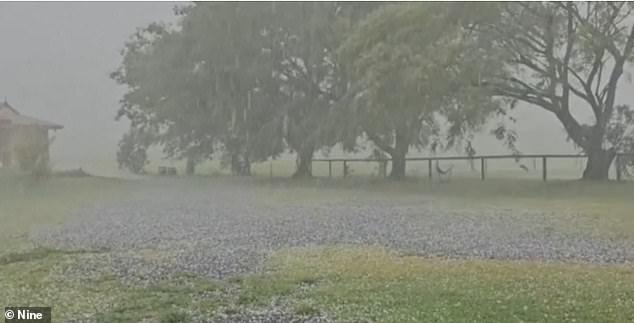
Four centimeter hail was seen in Beaudesert (above) on Saturday afternoon, ahead of more storms
One weather guru has warned Australians in the Northern Territory and Far North Queensland that they are not out of the woods yet, with the system likely to 're-intensify' and develop again as another cyclone.
BOM senior meteorologist Angus Hines delivered the alarming news in a Saturday afternoon weather update, warning that the remnants of Jasper could soon return with force.
“The risk of re-intensification does increase,” he said.
'We have a modest chance that Jasper will turn into a tropical cyclone again in the second half of next week, from Wednesday to Friday.
“If so, there are a number of paths the system can take.
“It could affect parts of the upper Northern Territory, but it could even double and hit Far North Queensland in the second half of next week and into next weekend.”
The Jasper system is likely to reach a tropical low as it moves away from the Cape York region of Far North Queensland and enters the warm waters of the Gulf of Carpentaria from Sunday to Tuesday.
