Scientists finally reveal the cause of the 1831 global cooling that caused crop failures and devastating famines
It’s been almost 200 years since a global cold snap led to widespread crop failures and devastating famines.
Now a new study by scientists at the University of St Andrews has finally found the cause.
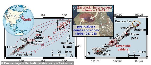
The Zavaritskii volcano on the remote, uninhabited Russian island of Simushir, part of the Kuril Islands, erupted in 1831, experts reveal.
The dramatic event injected volcanic ash into the atmosphere, blocking enough sunlight to cause a brief global cooling period.
And the resulting weather change included reduced rainfall from Africa and India to Japan, causing major famine due to poor crop yields.
‘Although scientists have long known that a very large eruption occurred in 1831, its source has remained a mystery,’ lead study author Dr Will Hutchison told MailOnline.
‘Our chemical fingerprints from the ash reveal that the source of this mysterious climate-changing eruption was this remote volcanic island in the Kuril Islands.’
Zavaritsky has not erupted since 1957, but is still considered an active volcano, meaning it has the potential to erupt again in the future.
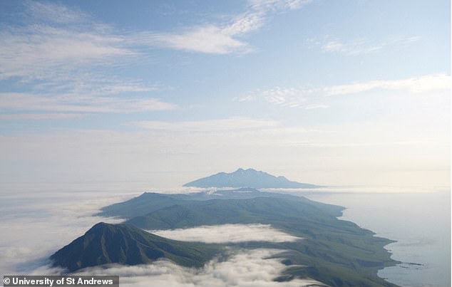
The mysterious location of a massive volcanic eruption that has puzzled scientists for nearly 200 years has finally been solved. Pictured is Zavaritskii Caldera, the newly revealed site of the 1831 eruption
In the summer of 1831, a massive volcanic eruption spewed sulfurous gases into the atmosphere, reflecting sunlight and causing a global cooling of about 1.8 °F (1 °C).
This cold weather, well documented worldwide at the time, led to “significant cooling of the Northern Hemisphere’s climate,” causing crop failures and famine, the team says.
Historical observations point to a blue, purple and green sun at various locations in the Northern Hemisphere in August 1831.
Such phenomena are caused by the scattering and adsorption of solar radiation in a dense aerosol plume, which is usually caused by a volcanic eruption.
Even the German composer Felix Mendelssohn wrote about the terrible conditions during his summer trip through the Alps in 1831.
Mendelssohn said: ‘Ferrible weather, it has rained all night and again all morning, it is as cold as in winter, there is already deep snow on the nearest hills…’
Although scientists knew it was a major event that caused climate change and social unrest, the identity of the volcano responsible remained unknown and hotly debated until now.
For the study, Dr. Hutchison and his team recorded ice core data from Greenland’s polar ice caps dating back to 1831.

Dr. Hutchison and his team managed to date and match the ice core deposits with the Zavaritskii volcano on the remote, uninhabited island of Simushir (pictured), part of the Kuril Islands.

Dr. Hutchison and his team were able to accurately date and match the ice core deposits to the Zavaritskii volcano on the remote, uninhabited island of Simushir, part of the Kuril Islands.
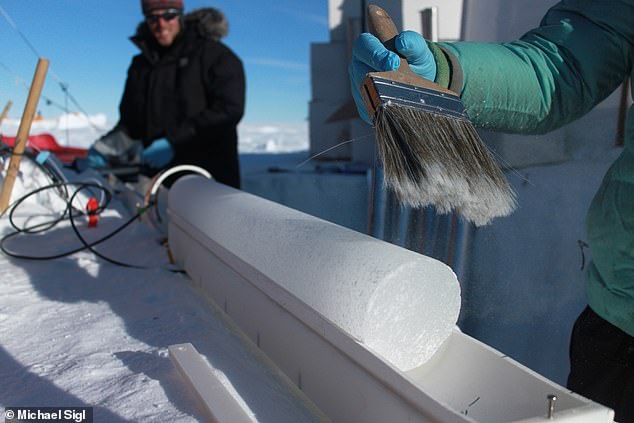
These ice cylinders provide a valuable record of the climate conditions at the time of formation, including local temperature, the chemical composition of the atmosphere and, crucially, volcanic activity.
“Scientists are drilling into the ice and pulling up layers of snow and ice, giving us annual data on past climate and atmospheric conditions,” Dr Hutchison said.
‘Only in recent years have we developed the ability to extract microscopic ash shards from polar ice cores and perform detailed chemical analyzes on them.
“These shards are incredibly small, about one-tenth the diameter of a human hair.”
After laboratory analysis, they identified a “perfect fingerprint match” with ash deposits from the remote Kuril Islands.
“We were able to identify Zavaritsky as the source because the magma it produces has a distinctive chemistry, different from that of neighboring volcanoes,” Dr. Hutchison to MailOnline.
The study, published in the journal Proceedings of the National Academy of Sciences, finally solves a nearly 200-year mystery.
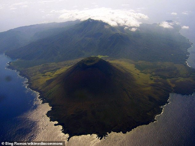
The 1831 eruption was initially attributed to the Babuyan Claro volcano in the Philippines, but an earlier study “found no firm evidence for an eruption at this time.”

For the study, ice cores (photo) were collected from various locations in the Greenland ice sheet. These ice cylinders provide a valuable record of the climate conditions at the time of formation, including local temperature, the chemical composition of the atmosphere and, crucially, volcanic activity.

The 1831 eruption was initially attributed to the Babuyan Claro volcano in the Philippines (pictured), but an earlier study ‘found no firm evidence for an eruption at this time’
Another candidate is Ferdinandea (also known as Campi Flegrei Mar Sicilia or Graham Island), which is located about 50 kilometers southwest of Sicily, Italy.
Ferdinandea did indeed erupt in July to August 1831, but this was only a ‘modest’ ‘phreatomagmatic’ eruption, resulting from magma erupting through water.
“The size of Ferdinandea’s eruption is also unusually small for a climate-changing eruption,” the team says in their paper.
The study also contributes to the history of the Zavaritsky volcano, helping to record when it erupted in the past.
The 1831 eruption was very remote, yet had a significant global impact on the climate and serious consequences for the human population.
However, predicting volcanic eruptions is difficult, even with historical eruption data.
“This island is uninhabited, no one is monitoring this volcano, so our work illustrates how difficult it will be for scientists to detect when and where the next major climate eruption will occur,” Dr Hutchison added.
