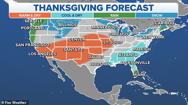
New weather maps show brewing coastal storm along the Northeast is poised to destroy Thanksgiving travel plans for millions of Americans
Millions of Americans could face delays and disruption to their Thanksgiving travel plans as new weather maps show a threatening coastal storm could hit as early as Friday.
A cold front and storm system off the East Coast are being monitored by weather forecasters as more than 55 million Americans prepare to travel ahead of the holidays next week.
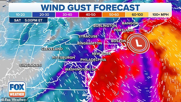
Coastal communities in New England will experience the worst impacts, including high winds and rain.
Wind gusts of at least 20 to 30 km/h are expected to hit the region on Friday and last until Saturday.
Fox Weather trackers suggest the wet weather will begin on Friday and continue through Saturday.
The northeast coast will be hardest hit by gusty winds and storms, weather forecasters predict
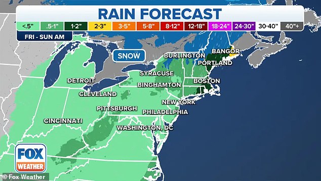
Coastal areas of New England, including Martha’s Vineyard and Downeast Maine, are likely to see several inches of rain through Saturday
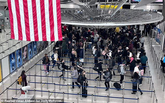
AAA predicts that 55.4 million travelers will travel 50 miles or more from home for Thanksgiving this year
Precipitation may even include snow showers in the higher elevations of New York, New Hampshire, Vermont and Maine.
Martha’s Vineyard and Downeast Maine also have a chance of several inches of rain through Saturday.
Coastal Maine and Downeast Maine “could see quite a bit of rain over the next few days with this storm,” said Fox Weather meteorologist Haley Meier.
However, much of the I-95 corridor will escape the worst of the precipitation, with cities like Philadelphia and New York expected to see no more than an inch of rain.
“You’ve got a front approaching from the west and that’s helping to guide this system along the coastline,” Fox Weather meteorologist Ian Oliver explained.
‘We had two dry weekends in a row in the northeast. Looks like it won’t be three,” Oliver added.
The National Weather Service office in Boston says it doesn’t expect any flooding risks from the storm system, but it will be windy at times.
Coastal Maine and Downeast Maine “could see quite a bit of rain over the next few days with this storm,” said Fox Weather meteorologist Haley Meier.
The I-95 corridor will largely escape the worst of the precipitation, with cities like Philadelphia and New York expected to see no more than an inch of rain
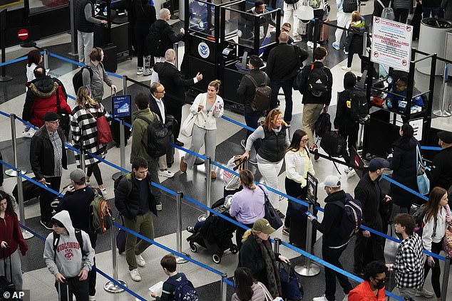
After the holidays, most Americans will travel back home on Sunday, November 26 or Monday, November 27, so it’s worth preparing for big airport crowds on those days
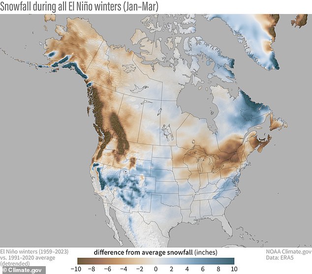
Snowfall during all El Niño winters (January-March) compared to the 1991-2020 average – with blue colors showing more snow than average and brown less snow than average
AAA predicts that 55.4 million travelers will travel 50 miles or more from home for Thanksgiving this year, a 2.3 percent increase from last year and the third highest forecast since 2000.
Road weather conditions will be of paramount importance as most Thanksgiving travelers will drive to their destinations, the organization predicts, with 49.1 million drivers expected to get behind the wheel.
Transportation software company INRIX expects Wednesday, November 22, to be the busiest day on the road during the Thanksgiving travel period – with average travel times as much as 80 percent higher than normal in some metropolitan areas.
About 4.7 million people will fly during the holiday, the highest number of Thanksgiving air travelers since 2005, and 1.55 million travelers will reach their destinations by cruise, bus and train.
The most popular domestic destinations are New York, Las Vegas, Orlando and Miami, Laura Lindsay, global travel trends expert at Skyscanner, told USA Today.
This year will also be affected by an El Niño winter, caused by a shift in the distribution of warm water in the Pacific Ocean around the equator.
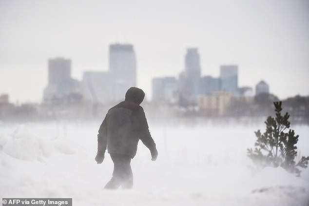
The shift is having a major impact on weather patterns around the world – and this year’s El Niño is expected to be the strongest since 2015 – which saw the warmest US winter on record (photo: a man takes a walk in front of the skyline Minneapolis at Bde Maka Ska Park during a snowstorm in Minneapolis, Minnesota, on February 22, 2023)
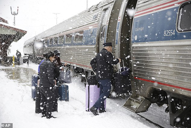
Last week, a storm moved out of the Pacific Northwest, covering the area from Montana to North Dakota with nearly a foot of snow and bringing cold air south (Photo: Conductor helps passengers board the southbound Amtrak Vermonter in Waterbury , Virginia, during a snowstorm on Tuesday, March 14, 2023)
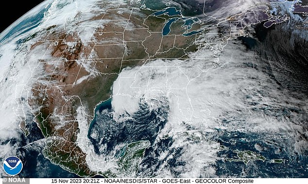
New weather maps show the coastal storm along the northeast coast
This change in air and ocean currents around the equator can have a major impact on weather patterns around the world by creating pressure anomalies in the atmosphere.
The shift is having a major impact on weather patterns around the world – and this year’s El Niño is expected to be the strongest since 2015 – which saw the warmest US winter on record.
During an El Niño, temperature fluctuations in winter produce more snow than average in the US Midwest and western states such as Colorado, New Mexico, Arizona and Utah.
New England is experiencing much less snow than normal during the intense El Niño seasons – New York, Vermont and parts of Maine are likely to see much less snowfall this winter than the 1991-2020 average.
