More than three million people are under tornado watch in Arkansas, Texas, Louisiana and Oklahoma
>
Millions of people are under a tornado watch across the Upper Midwest and Plains after a massive deadly storm swamped California.
The areas of Arkansas, Texas, Louisiana and Oklahoma received their first tornado warning of 2023 on Monday, which will be in effect until 9 p.m. CST.
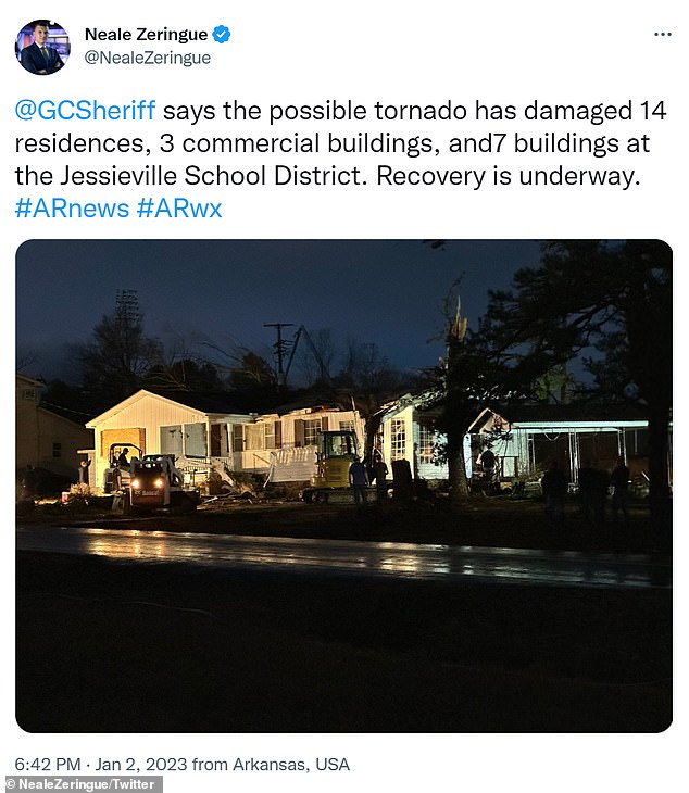
Jessieville in Arkansas was hit by a tornado Sunday afternoon leaving 14 homes, three buildings and up to seven buildings in a local school district damaged. It is not clear if there were any injuries.
Tornadoes aren’t the only threat to the area this week, as the National Weather Service warned of heavy snow, freezing rain and gusty winds through Wednesday.
Experts urged anyone in the tornado warning areas to seek shelter immediately rather than wait until the threat appears.
“If you wait for a warning to be issued, it’s too late,” Brad Bryant, an NWS meteorologist, told CNN. “You need to have a safe haven plan ahead of these storms.”
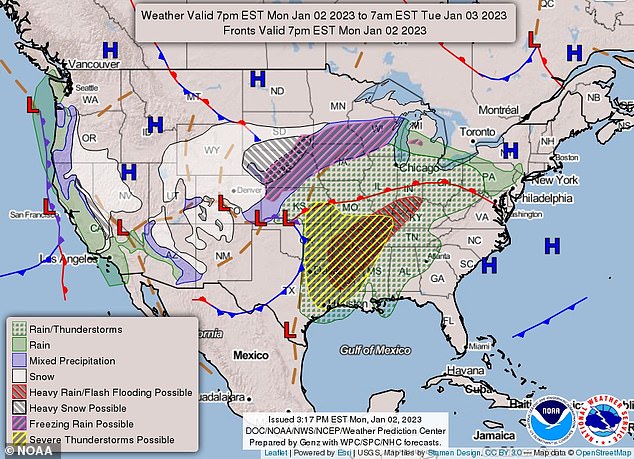
Millions are under a tornado watch as a storm threatens the Midwest and Plains. The threat is in effect in Arkansas, Texas, Louisiana and Oklahoma until 9 pm CST. But thunderstorms are possible through Tuesday.
While the tornado warning is in place through Monday night, Alabama, Mississippi and Louisiana may experience high, damaging winds before Tuesday.
The current storm warning threatens about 30 million people in the Mid-South and Mississippi Valley, who are at risk of two to four inches of rain and flash flooding through Tuesday.
The National Weather Service warned that travel may be affected until the storm subsides on Wednesday.
Parts of Nebraska, Minnesota and South Dakota are expected to receive up to 3 inches of snow per hour through Tuesday.
As the National Weather Service warned on Twitter: “A winter storm will move from Four Corners tonight across the Central Plains and Upper Midwest Monday and Tuesday with areas of heavy snow, sleet and freezing rain.”
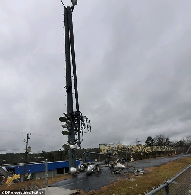

Arkansas was hit by a tornado that damaged multiple homes and a local school on Sunday. The storm appeared to have damaged the lights in a football stadium.
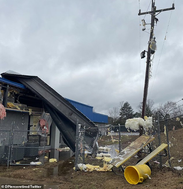

Damage was observed in multiple areas around Jessieville in Arkansas

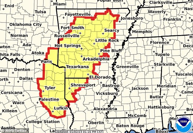

The threat is in effect in Arkansas, Texas, Louisiana and Oklahoma until 9 p.m. CST
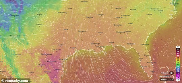

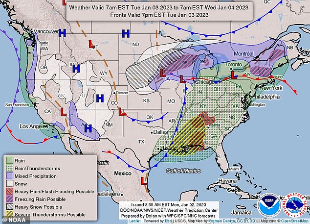

The current storm warning threatens an estimated 30 million people in the Mid-South and the Mississippi Valley. Parts of Nebraska, Minnesota and South Dakota are expected to receive up to 3 inches of snow per hour through Tuesday.


The National Meteorological Service alerted about the conditions that are coming for this week
Ice up to a quarter inch is also likely in eastern Nebraska and southern Minnesota.
Weather conditions can lead to dangerous trips, tree damage, and power outages.
Meanwhile, more excessive rain could hit California again on Wednesday after the northern part of the state plummeted with widespread flooding and heavy snow over the weekend.
At least three people have died from the treacherous conditions, including a person found dead inside a completely submerged car Saturday in Sacramento County and a 72-year-old man who died after being struck by a fallen tree in a park. Santa Cruz.
The storm left 300,000 Californians without power on Saturday, but as of Monday that number dropped to more than 50,000.
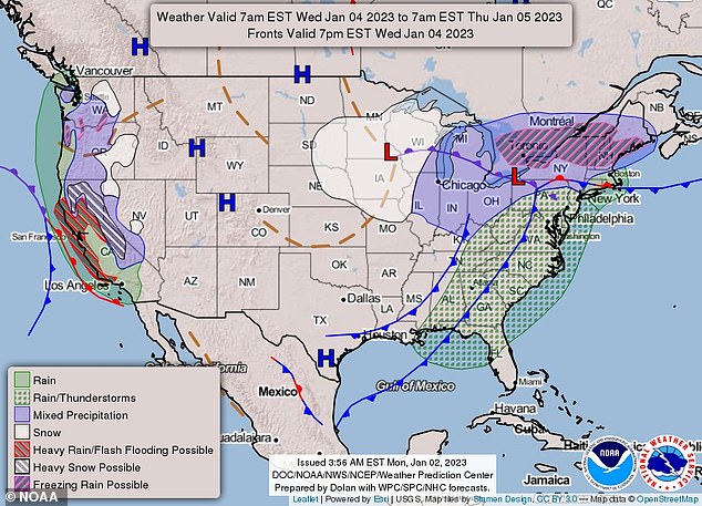

As the storm moves further east, rain and thunderstorms are forecast to hit the coast.


Meanwhile, more excessive rain could hit California again on Wednesday after the northern part of the state slumped with widespread flooding over the weekend. A car is seen submerged in water in Sacramento
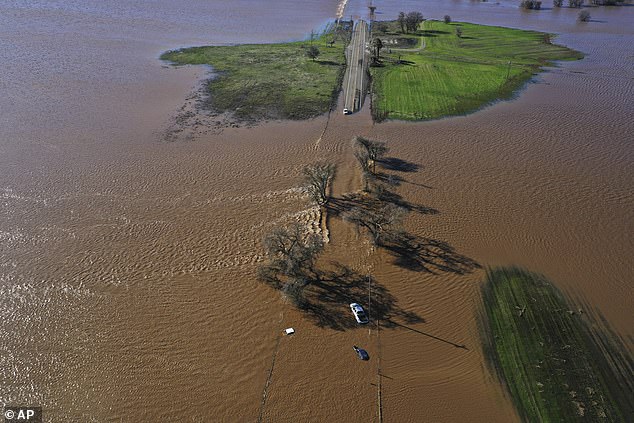

Three vehicles were seen submerged on Highway 99 in southern Sacramento County on Sunday.


Two more cars were seen submerged in water as power went out to more than 170,000 homes over the weekend.
The storm now heading south is attributed to the so-called atmospheric river, a region in the atmosphere that can carry moisture for thousands of kilometers.
That ‘river’ has already devastated the Sacramento area, where emergency crews spent the weekend rescuing multiple flood victims by boat and helicopter, and responding to calls of downed trees and disabled vehicles trapped in the floodwaters. flood.
An evacuation order was issued for rural Point Pleasant in Sacramento County on Sunday, just a day after rising waters forced evacuations in Wilton, California, as well as three communities near the city of Watsonville in Santa Cruz County.
A flash flood watch was also issued along and west of the 5 Freeway leading to the Sacramento River, where concerns of excessive rainfall and flooding already existed.
A levee was eventually breached and breached by the River Cosumnes on Saturday night due to heavy rain, leaving Wilton under water. And on Sunday morning, Sacramento County spokesman Matt Robinson said helicopter footage showed a second levee had breached.
Residents in areas near Interstate 5 were told to “prepare to leave the area now before roads are closed to evacuate the area.”
The Sacramento County Office of Emergency Services also urged rural area residents to move their livestock to higher ground.
Meanwhile, on Highway 99, videos showed cars submerged past the door handles.
The highway was later closed south of Elk Grove in Sacramento County.
Sacramento County officials were eventually forced to issue a local state of emergency.
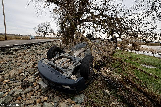

Some cars were seen overturned and off the side of the road in Sacramento County
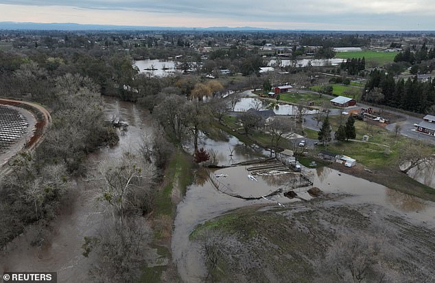

An aerial shot showed flooded areas around homes after Monday’s storm.
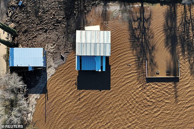

Flooded buildings were seen after the storm hit Sacramento County
Now, northern and central California are again at risk of more heavy rain and flooding beginning Wednesday through Thursday, according to the NWS.
Then the risk of flooding leads Thursday and Friday to move further inland and south of the state.
It’s unclear if excessive rainfall will make a dent in California’s never-ending drought, which is headed for its fourth driest year on record.
