Long lost continent is FOUND off the coast of Australia: Landmass nearly twice the size of the UK was home to half a million humans 70,000 years ago, scientists say
In the distant past, rising sea levels hid large swathes of our planet’s land that humans once called home.
Now scientists have found evidence of a lost continent off the northern coast of Australia, where half a million people lived some 70,000 years ago.
This landmass, known as the North West Shelf, was about 1.6 times the size of Britain and included archipelagos, lakes, rivers and a large inland sea.
The archipelagos were so large they could have acted as ‘stepping stones’ for migration from Indonesia to Australia, experts say.
Unfortunately, the North West Shelf was lost about 10,000 years ago when sea levels rose, and now lies about 90 meters underwater in the Timor Sea.
This landmass, known as the North West Shelf, was about 1.6 times the size of Britain and included archipelagos, lakes, rivers and a large inland sea. The archipelagos were so large that they could have acted as ‘stepping stones’ for migration from Indonesia to Australia
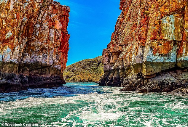
The sunken landscape now extends between the Kimberley region (pictured) and the Arnhem region of northern Australia
The new study was led by Kasih Norman, an archaeologist at Griffith University in Queensland.
“We reveal details of the complex landscape that existed on the Northwest Shelf of Australia,” say Norman and colleagues.
“It was unlike any landscape you find on our continent today.”
The last ice age came to an end about 18,000 years ago.
The subsequent warming caused sea levels to rise and drowned large parts of the world’s continents, including a huge landmass surrounding Australia.
This landmass connected the Australian mainland to New Guinea and Tasmania – now collectively known as Sahul – but as sea levels rose, parts became submerged.
This process split the supercontinent Sahul into New Guinea and Australia, cutting Tasmania off from the mainland.
The Northwest Shelf of Sahul in particular was a “vast, habitable realm” and a “single cultural zone” with similarities in basic stone ax technology, rock art styles and languages, the experts say.
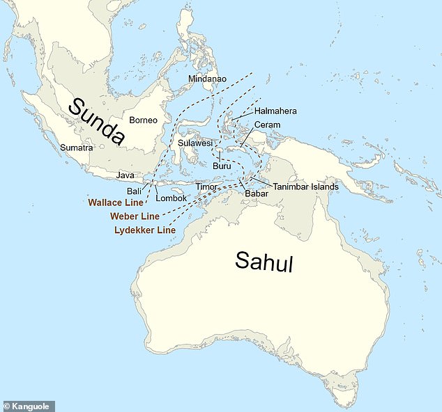
Sahul was a supercontinent consisting of the present-day landmasses of Australia, Tasmania and New Guinea
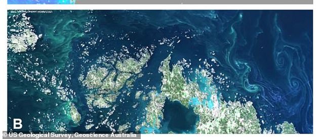
A modern-day example of an archipelago on a submerged continental shelf is the Åland Islands near Finland.
For the study, they analyzed bathymetric data – information about the depths and shapes of underwater terrain – in the North West Shelf region.
They also looked at historical sea level data to help estimate when the region was populated and when it was lost.
Rapid global sea level rise between 14,500 to 14,100 years ago and 12,000 to 9,000 years ago resulted in the rapid flooding of about half of the Northwest Shelf with seawater, they reveal.
The human population would have witnessed an ‘advancing coastline’ and further retreat onto the Australian mainland.
This resulted in an increase in population in the Kimberley and Arnhem regions of Northern Australia, evidenced by distinctive new rock art styles in both regions.
The team also pointed to stone tools recently found on the seabed off the coast of Western Australia’s Pilbara region.
Australia’s now submerged continental shelf was thought to be little used by indigenous people, but the new study suggests this is not the case.
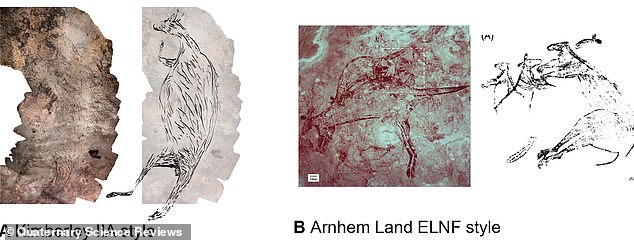
Pictured are similar rock art styles in the Kimberley (left) and Arnhem (right) regions of northern Australia. It is possible that they were produced by people who were displaced from the North West Shelf when it was flooded
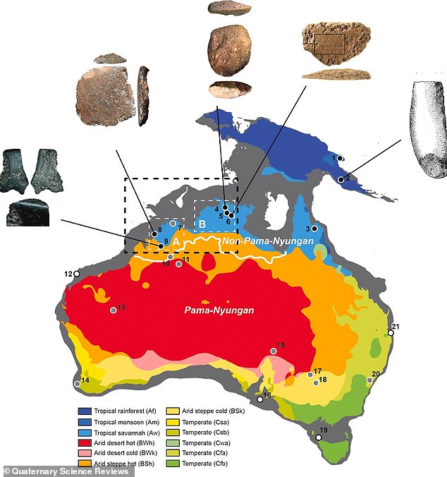
North West Shelf (indicated here by a dotted black box) was probably a ‘single cultural zone’ with similarities in ground stone ax technology and rock art styles. Pictured: Early ax technology found in Australia, within and beyond the North West Shelf region
If they were anything like North West Shelf, they were ‘rich ecosystems’ with impressive populations comparable to today’s towns and cities.
“Our ecological models show that the now submerged North West Shelf could have supported between 50,000 and 500,000 people at various times over the past 65,000 years,” the team says.
‘The population would have peaked about 20,000 years ago at the height of the last ice age, when the entire plateau was dry land.
‘Many large islands off the Australian coast – islands that were once part of the continental shelf – show signs of occupation before sea levels rose.’
The research was published in Quaternary Science Reviews.
