How ‘devilish winds’ are fueling California’s deadly wildfires that are raging across the state
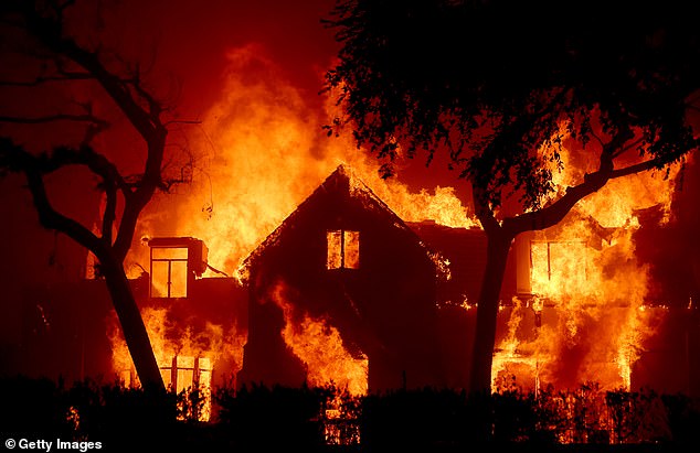
A wildfire rages through Los Angeles again, leaving hundreds of millions of dollars in damage.
While it’s not clear exactly how it started, most wildfires are usually traced to human-caused mistakes, such as an unattended campfire or a discarded cigarette.
Weather and environmental conditions then determine how serious and widespread the fires become.
Experts say heavy rains from El Niño last year fueled vegetation growth in the Los Angeles area, which had since dried out and become highly flammable.
Once ignited, the strong wind fanned the flames.
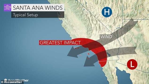
Southern California was battered by “devil winds,” formally known as Santa Ana winds. These are warm, gusty northeasterly winds that blow from the interior of the region towards the coast.
They are also drier because they move in the opposite direction of the normal onshore flow that carries moist air from the Pacific Ocean to the region.
The Santa Ana winds caused humidity to drop and vegetation to dry out, which then became susceptible to fire.
The enormous wind speeds are capable of fanning every spark into a fast-spreading, devastating fire that engulfs thousands of hectares in hours.
The Palisades Fire, currently the largest of 35 active fires, has consumed nearly 3,000 acres and is zero percent contained

The Santa Ana winds, also known as the “devil winds,” are extremely dry, fast winds that periodically blow from the inland mountains to the coast of Southern California.
Santa Anas were created by high pressure over the Great Basin, the desert interior of the West that overlaps several states.
The sinking air dries out as it moves clockwise toward Southern California, where it encounters towering mountain ranges that separate the desert from coastal metropolitan areas.
The air begins to gain speed as it moves over mountains and canyons, becoming drier and warmer as it moves further.
Earlier this week, an area of high pressure in the Great Basin combined with a developing storm in northwestern Mexico to create Tuesday’s storm, according to AccuWeather meteorologist Gwen Fieweger.
Santa Ana winds moved through Southern California at nearly 90 mph on Tuesday, and with January’s already bone-dry conditions, it didn’t take long for fires to ignite.
The Palisades fire, currently the largest of 35 active fires, started around 10:30 a.m. Tuesday in the Pacific Palisades, a Los Angeles neighborhood located between the Santa Monica Mountains and the Pacific Ocean.
It has consumed almost 3,000 hectares and is zero percent contained, according to the newspaper California Department of Forestry and Fire Protection.
Later that evening, the Eaton fire started near a nature preserve in Altadena, California, around 6:30 p.m. It has consumed more than 2,000 hectares and is zero percent contained.

These fast-spreading fires were sparked by a Santa Ana storm that hit Southern California on Tuesday

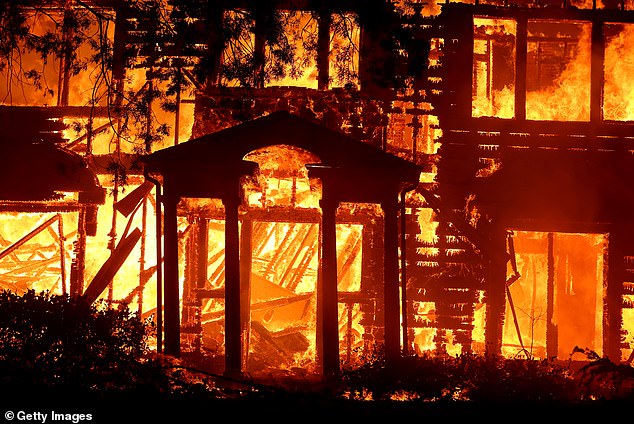
The fires have destroyed more than 1,000 buildings in the affected area, with more damage yet to be done, officials warn
Within 24 hours, fires destroyed nearly 15,000 acres, prompting Governor Gavin Newsom to declare a state of emergency as fires destroyed more than 1,000 buildings, caused nearly 400,000 power outages and forced tens of thousands of people to evacuate.
At least two people have reportedly been killed and many have suffered serious injuries. Officials warn the worst is yet to come.
“Everyone is at the mercy of the wind right now,” Brian Rice, president of the California professional firefighters union, told CNN.
He told reporters that wind gusts of 100 to 130 km/h are currently lashing the state. “You have no control over that,” he said.
“These are hurricane winds,” Capt. Sheila Kelliher of the Los Angeles County Fire Department told CBS on Wednesday. “It’s extreme.”
The wind is not expected to calm down anytime soon. On Tuesday, meteorologists predicted the storm will last through Wednesday and finally begin to weaken on Thursday.
‘The strongest winds are expected on Wednesday afternoon. Winds will decrease Thursday, but parts of Southern California will remain breezy,” The Weather Channel reported.
