El Nino is officially declared in Australia: Here’s why it’s set to be a very hot and dry summer
Australia is on alert for bushfires after the Bureau of Meteorology confirmed the onset of an El Nino weather pattern, raising the risk of a sweltering hot and dry summer.
It follows a period of breaking global weather records and a series of natural disasters that have led to deadly heatwaves and devastating floods in the Northern Hemisphere.
El Nino is the opposite of La Niña – which causes the flooding seen in Australia in recent years – and causes hot, dry weather that can increase the risk of bushfires.
On Tuesday, the Bureau of Meteorology formally declared an El Nino weather event for Australia, two months after the World Meteorological Organization announced a global El Nino was underway.
They also confirmed a positive dipole in the Indian Ocean, which is likely to reduce rainfall in western Australia.
When the two come together, the blistering double whammy can be devastating.
Australia is on alert for bushfires after the Bureau of Meteorology confirmed the start of an El Nino weather pattern, raising the chances of a sweltering hot and dry summer
“These conditions are associated with an increase in fire danger and the risk of extreme heat,” Karl Braganza, BoM manager of climate services, said on Tuesday.
‘Both climate factors have a significant impact on Australia’s climate, specifically promoting warmer and drier conditions, especially in spring, but also in early summer.
“It is now really up to individuals and communities to prepare for a summer full of heat and fire danger.”
Weatherman has been warning of a possible El Nino in Australia since May, but the BoM said they had been waiting for certain key markers before officially announcing this.
“We waited another week to say it has settled into that pattern,” Mr. Braganza said.
“Given all these indicators, and we really have to meet three of our four criteria to be able to announce an event, today we succeeded.”
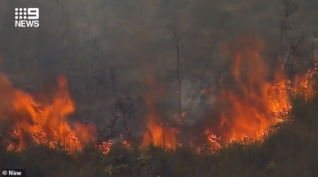
Australia is already battling several bushfires on its east coast, with homes in Queensland evacuated on Sunday and a massive blaze sweeping through the countryside near Cessnock in NSW.
The area around Coles Bay and Friendly Beaches in eastern Tasmania were also evacuated on Tuesday after a bushfire there grew out of control and threatened local homes.
Weathermen are also warning of ‘catastrophic’ fire danger on the NSW south coast as high temperatures are accompanied by unexpectedly strong winds.
Large parts of NSW and eastern Victoria are experiencing maximum temperatures 10 to 15 degrees above the September average.
Damaging winds, driven by a cold front, increase the danger.
“As we look to the next seven days, today we see catastrophic fire dangers for the far south coast,” a BoM spokesperson said.
“That will decrease a bit tomorrow as we expect a cold front to come through that will cool things down a bit.
“However, tomorrow we will see serious fire dangers around the Greater Sydney and Greater Hunter districts.
‘That will probably lead to a total fire ban, depending on the decision of the National Fire Brigade there.

When an El Nino and a positive dipole converge in the Indian Ocean, the consequences can be devastating
“Very hot and quite windy conditions are expected in some form tomorrow across central and northern parts of New South Wales before that cold front comes through. ‘
The front has prompted severe weather warnings for parts of South Australia, Tasmania, Victoria and southern NSW, with the possibility of showers, gales, small hail and snow in some parts.
And while that will bring welcome relief from the heat in Victoria and NSW, the front will push the extreme heat further north into Queensland, with the impact there being most pronounced on Thursday.
Fire danger will also increase across the state, especially in the south, with the Channel Country expected to experience extreme fire danger on Thursday and Friday.
“We are in a period of very, very warm weather that has not been seen for many, many years,” the BoM spokesman said.
‘What’s quite unusual about this heat at the moment is how long-lasting it is. We often see a few warm days starting in September.
“But the fact that we’ve seen so many warm days in a row for seven, eight days in New South Wales and Victoria is quite unusual.”
More to come
