Cyclone Jasper's 'red zones' in Cairns and Port Douglas are named as Aussies are ordered to brace for impact and 'prepare for isolation' and the Defense Force urgently evacuates the island in the path of a monster storm
Thousands of people have been warned to brace for impact as Cyclone Jasper steams towards Australia – with residents told to 'prepare to isolate' and an island evacuated.
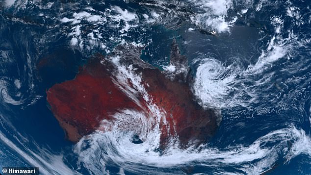
Cyclone Jasper continues to head towards the Queensland coast, where it is expected to make landfall as a Category 2 system, most likely between Cape Flattery and Cardwell.
The Bureau of Meteorology said there was still a 'slim chance' of a severe Category 3 impact.
The storm is forecast to bring damaging winds and heavy rainfall that could lead to flash flooding – and now there are fears of a tidal wave.
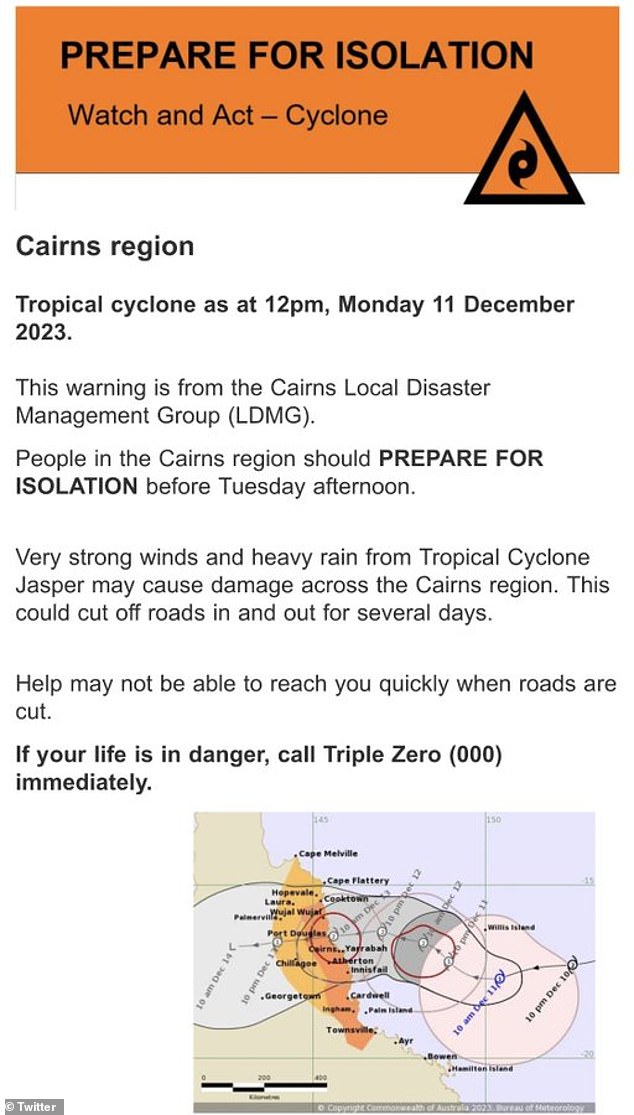
The Cairns region has received a Watch and Act notice, warning residents to prepare to isolate before Tuesday afternoon.
The city of Port Douglas has been identified as a possible 'red zone' in the event of significant tidal waves as a result of the cyclone. The dotted line shows the path of the cyclone

Cairns has received a Watch and Act notice as the monster storm makes its way towards the Queensland coast
“Very strong winds and heavy rainfall from Tropical Cyclone Jasper may cause damage across the Cairns region,” the statement said.
'As a result, the roads may be closed for several days. Help may not reach you quickly if the roads are closed.'
The city of Port Douglas has also been identified as a potential 'red zone' in the event of significant tidal waves as a result of the cyclone.
Meanwhile, the Australian Defense Force has evacuated Bureau of Meteorology (BOM) staff from a small weather station on an island in the storm's path.
Willis Island, about 450 kilometers off the coast of Cairns, is one of the most remote weather bases in the world.
As the cyclone strengthened off the coast last week, BOM became concerned about the safety of the four employees living at the station.

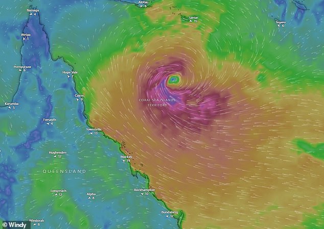
The storm is forecast to bring damaging winds and heavy rainfall that could lead to flash flooding – and there are now fears of a tidal wave

Tropical Cyclone Jasper continues to move towards the Queensland coast where it is expected to make landfall as a Category 2 system
The Australian Navy's guided missile destroyer HMAS Brisbane was diverted from its operations in the Coral Sea to the small island.
A Seahawk helicopter was sent on Saturday to evacuate BOM personnel and make trips to get them to safety.
Defense said the emergency evacuation took place in severe weather conditions, including three-metre high waves and wind speeds of 25 knots.
HMAS Brisbane is en route to Sydney, where BOM personnel will disembark.
There are also fears on Palm Island – where about 2,500 people live – that it could be directly in the line of fire.
Council leader Michael Bissell said the island was running out of sandbags as weather prevented them from being shipped from the mainland.
“We are likely to have a shortage of non-perishable food items if it lasts more than a few days, but… we have good support from relevant agencies,” he added.
'The store is well stocked, the hospital is well stocked, there are staff present, the police are well staffed. We have spoken regularly with SES and QFES to ensure we have what we need.
“We have about 15,000 liters of diesel there, which is enough for two and a half weeks of general use.”
The cyclone's winds could extend as far north as Cape Melville, on the east coast of the Cape York Peninsula, and as far south as Townsville, the Bureau of Meteorology warned.

The Australian Defense Force has evacuated Bureau of Meteorology (BOM) personnel from a small weather station on Willis Island.

BOM personnel were welcomed aboard HMAS Brisbane following their evacuation from Willis Island
A tropical cyclone watch has been issued for Cape Melville to Townsville, including Cairns and Cooktown, with a flood watch also in place in these areas.
Heavy rain was also expected to develop along the coast from late Tuesday, before Jasper was likely to make landfall between Cooktown and Cardwell on Wednesday, where it could develop into a category three cyclone.
Flooding was possible starting Wednesday for the northern tropical coast, parts of the Cape York Peninsula and Gulf Country, the agency warned.
A severe weather warning for damaging winds was also in force for parts of the Herbert, Lower Burdekin, Central Coast and Whitsundays districts on Monday, with the agency predicting gusts of up to 90km/h in some areas.
Jasper is not only the first tropical cyclone of the season, but it is also believed to be the first to emerge off the coast of Australia during an El Nino in December.
