One of Britain’s most important Roman roads has finally been FOUND after 2,000 years as archaeologists make a ‘remarkable’ discovery beneath the iconic London street
After almost 2,000 years, part of one of Britain’s most important Roman roads has been found.
Archaeologists have uncovered part of the ancient Roman road known as Watling Street, beneath London’s modern Old Kent Road.
Watling Street was paved by the Romans in 43 AD and ran 275 miles from Dover to the West Midlands.
This is the first time researchers have found physical evidence that parts of the Roman highway survive directly beneath its modern counterpart.
Although Roman roads are generally straight, it has proven extremely difficult to find hard evidence of the path taken by Watling Street through the capital.
However, during work to expand the Southwark district’s heating network, a section measuring 5.8 meters wide and 1.4 meters high was found beneath the busy street.
Gillian King, director of archeology at RPS Consulting Ltd, says the discovery of this section ‘reshaped the Roman road map for London’.
Ms King added: ‘It is an important archaeological finding for London.’
Archaeologists have found part of one of Britain’s most important Roman roads, directly beneath London’s modern Old Kent Road (pictured), 2,000 years after it was first built
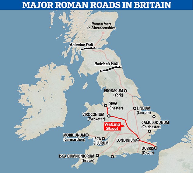
The Roman road known as Watling Street ran from Dover, through London and up to the Roman town of Viroconium (now Wroxeter near Shrewsbury) to the fortress of Deva (now Chester)
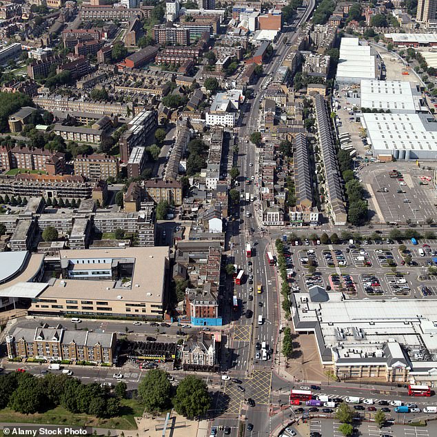
The Watling Street fragment was found directly beneath the Old Kent Road (photo). Although archaeologists know that the road passed through London, it has been difficult to determine the exact route until now
Watling Street was built shortly after the Roman invasion in 43 AD and served as one of the main thoroughfares in Roman Britain.
It ran northwest from the crucial port of Dover, via Verulamium (modern St Albans) to the Roman town of Viroconium (Wroxeter near Shrewsbury) and the fortress of Deva, now Chester.
The road was so important that it was even used by visiting emperors, including Hadrian in 122 AD when he ordered the construction of Hadrian’s Wall to separate England and Scotland.
After the collapse of the Roman Empire, the Anglo-Saxons called Wroxeter ‘Wætlingaceaster’, which gradually changed to ‘Watling’, after which the road was named.
Like many Roman roads, Watling Street’s solid construction ensured that it remained an important part of the medieval transport system and was slowly incorporated into our modern road network.
Although we have a good idea of the road’s general route from historical records, archaeologists have previously struggled to identify the path through London.
However, as Southwark Council prepared for construction work, archaeologists were able to uncover an entire section of Watling Street.
The section lies south of the junction of Old Kent Road and Ilderton Road and is remarkably well preserved for its age.
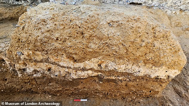
The road (photo) consists of three layers: a compacted gravel closed by two layers of chalk, with another layer of compacted gravel and sand on top
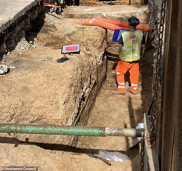
Archaeologists have excavated a 5.8 meter wide and 1.4 meter high section of the 2,000-year-old road
It consists of three different layers with a base of compacted gravel, closed by two layers of chalk and covered with another layer of compacted gravel and sand.
The archaeologists say that originally there would have been another surface layer of the same material around the level of the current street, but this has eroded over time and is now lost.
Dave Taylor, Archeology Project Manager at the Museum of London, said: ‘It’s amazing that this section of road has been around for almost 2,000 years.
‘There has been so much activity here over the last few hundred years, from sewers to electricity cables, tram lines and of course the construction of the modern road, so we are very pleased that such a substantial piece of Roman material remains.’
The researchers hope this discovery will lead to a better understanding of Watling Street’s route and Roman construction techniques.
Southwark Council archeology officer Dr Chris Constable said excavations in the early 1990s had found a section south of Old Kent Road, but the exact course had not been confirmed.
Dr. Constable said: ‘When planning this project we expected to resolve this issue, but the degree of road survival is remarkable.
“We hope this project will answer a number of other archaeological questions in the community.”
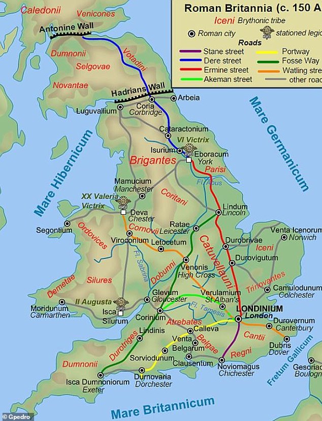
The Roman army created highways during the four centuries that Britain was under the rule of the Roman Empire. It is believed that the military built 2,000 miles (3,200 kilometers) of paved roads in Britain between 43 and 410 AD (map shown)
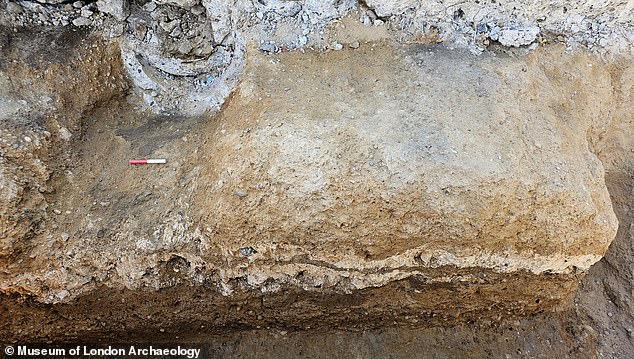
Archaeologists say there was once an additional layer on top that sat around the level of the modern street, but this has long since been worn away and lost.
The London section of Watling Street was first discovered in 1671 when Christopher Wren rebuilt St Mary-le-Bow after the Great Fire of London in 1666.
Before this discovery, much of what experts could learn about Watling Street came from a series of Roman documents called the Antonine Itinerary.
These papers record the names of military stations and the distances between them, allowing researchers to trace the route all the way to the Roman fort that would become Chester.
Archaeologists now believe the road ran from the bridgehead over the Thames to modern-day Newgate near the London Wall.
Watling Street then led over Ludgate Hill and the Fleet River, where it branched off into the main path towards the West Midlands and the Devil’s Highway west towards Silchester.

