Floods hit… the SAHARA! Shocking before and after satellite images show a huge lake emerging after the desert was struck by its biggest deluge for decades
It is known as one of the driest places on our planet.
But shocking before and after images show exactly what happened when the Sahara was hit by the biggest deluge in decades.
The images were taken by NASA’s Landsat 9, an Earth observation satellite that regularly sends back photos of our planet.
The first image shows the salt-covered Sebkha el Melah in Algeria on August 12, before the rain hit.
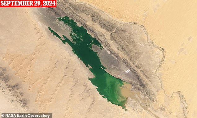
By September 29, a huge green lake had formed on the spot after storm runoff partially filled the short-lived desert lake.
And as global temperatures continue to rise, NASA says we could see more frequent flooding in parts of the Sahara.
“What will happen in the Sahara remains very unclear, but we hope that we will eventually develop a better understanding of the future of the Sahara by studying these lake-filling events,” said Moshe Armon, senior lecturer at the Hebrew University of Jerusalem. .
Shocking before and after images show exactly what happened when the Sahara was hit by the biggest deluge in decades
Although most of us know that the Sahara Desert was covered in sand about 11,000 to 15,000 years ago, it looked very different.
Geological and archaeological evidence indicates that vegetation, wetlands and even lakes once covered large areas of the desert.
Last month, however, hints of this wetter and greener past began to reemerge, after an extratropical cyclone dropped a deluge of rainfall across parts of North Africa.
On August 12, the OLI-2 camera aboard the Landsat 9 satellite captured a photo of salt-covered Sebkha el Melah.
The satellite observed that the lake began to fill in mid-September, and green water emerged on September 29.
“The lake lies along a ridge of the Ougarta Range and is fed by the Oued Saoura, an ephemeral river (also called a wadi) that enters from the southeast,” NASA explains.
By Oct. 16, the lake was one-third full, covering 74 square kilometers of water to a depth of 2.2 metres, Mr Armon said.
Filling a lake in the Sahara Desert is very rare.
Outside Algeria, the Moroccan government said two days of rainfall in September exceeded the annual average in several areas that receive less than 250 millimeters annually, including Tata, one of the areas worst affected.
Since June 2000, only six rain events have produced enough water to even fill the lake.
And only two other rain events – one in 2008 and one in 2014 – resulted in larger lake volumes than this.
However, when Sebkha el Melah becomes full, the water lingers for years.
After the lake was filled again in 2008, it did not dry completely until 2012.
“If we don’t get any more rain, it would take about a year for a depth of 2.2 meters, like we have now, to completely evaporate,” Dr Armon said.
Outside Algeria, the Moroccan government said two days of rainfall in September exceeded the annual average in several areas that receive less than 250 millimeters annually, including Tata, one of the areas worst affected.
In Tagounite, a village about 450 kilometers south of the capital Rabat, more than 100 millimeters were measured in a 24-hour period.
The storms left striking images of water rushing through the sands of the Sahara, dotted with castles and desert flora.
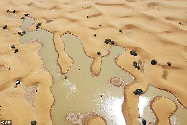
A view of lakes caused by heavy rainfall among sand dunes in the desert town of Merzouga, near Rachidia, southeastern Morocco, Wednesday, October 2, 2024. The Moroccan government said two days of rain in September exceeded annual averages in several areas
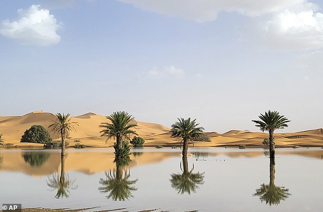
Palm trees are reflected in a lake caused by heavy rainfall in the desert town of Merzouga, near Rachidia, southeastern Morocco, Wednesday, October 2, 2024
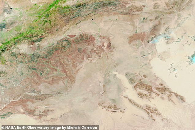
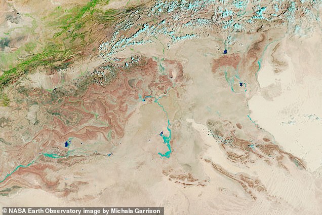
NASA satellites showed water rushing in to fill Lake Iriqui, a famous lakebed between Zagora and Tata that had been dry for 50 years.
In desert communities frequented by tourists, 4x4s drove through the puddles and residents admired the scene.
“It has been 30 to 50 years since we have had so much rain in such a short time,” said Houssine Youabeb of Morocco’s General Directorate of Meteorology.
Human-induced climate change has worsened deadly flooding in Africa, killing hundreds and displacing millions in Cameroon, Chad, Niger, Nigeria and Sudan, according to a study published today by the World Weather Attribution.
“These results are incredibly worrying,” said Izidine Pinto, one of the study authors and a researcher at the Royal Netherlands Meteorological Institute.
‘With every fraction of a degree of warming, the risk of extreme flooding will continue to increase.
Joyce Kimutai, a researcher at the Imperial Center for Environmental Policy, added: ‘Africa has contributed a small amount of CO2 emissions globally, but is the hardest hit by extreme weather.’

