Double weather threat strikes Australia – what the week ahead looks like in Sydney, Melbourne, Brisbane
A sweltering heatwave will continue to scorch parts of Australia, while thunderstorms and heavy rain will dampen other parts of the country.
Temperatures will continue to rise in Western Australia after the state became the hottest place on Earth on Sunday when the mercury reached 49.9 degrees Celsius at Carnarvon Airport.
Perth surpassed the record for the most consecutive days above 40 degrees Celsius within a one-month period, with the city marking its sixth straight day of unpleasant conditions on Monday.
The city’s previous record was set in 1933, when four days of temperatures above 40 degrees Celsius were achieved. The record was later equaled in 1985 and 2016.
Meanwhile, parts of Australia’s east coast are in for rain and thunderstorms in Sydney, Canberra and Brisbane.
Dry and mostly cloudy conditions are forecast for Melbourne, a welcome reprieve after Victoria was battered by monstrous storms last week.
Parts of Australia will experience another severe heatwave as hot and humid conditions persist (beachgoer photo)
Sydney
The NSW capital is set to reach a high of 27 degrees Celsius on Monday with showers and thunderstorms forecast for the city.
The port city is expected to remain mostly cloudy, but humid conditions are expected later in the week.
Highs of 31 degrees Celsius are reached on Thursday, while highs of 32 degrees are expected on Friday.
Weatherzone senior meteorologist Brett Dutschke told Daily Mail Australia that wet weather was also likely to occur throughout the week.
“There is a chance of showers or storms every day between now and Friday,” he said.
“Some storms could be severe.”
The thunderstorms are expected to provide some relief from the difficult conditions that will prevail in the city.
A cool southerly change is likely on Friday with an 80 percent chance of showers.
Melbourne
A cloudy start to the week is expected for Melbourne on Monday and Tuesday, due to a cool change brought by fresh southerly winds.
The city is expected to bear the brunt of warmer conditions, with the mercury reaching highs of 35 degrees Celsius on Thursday.
Another cool change is expected to happen later today to northerly winds, with the Bureau of Meteorology predicting gusts of up to 45 km/h.
Mr Dutschke said the cool change is expected to continue from Friday into the weekend, with temperatures reaching highs of 23 degrees Celsius on Sunday.
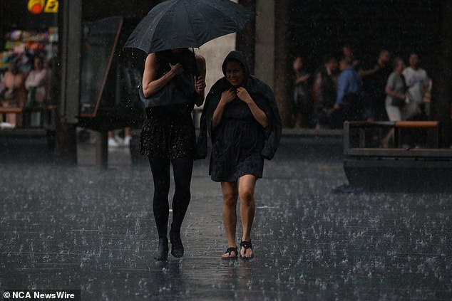
Sydney will see showers and thunderstorms for most of the week (pictured)
Brisbane
Thunderstorms and showers will drench the Sunshine State’s capital with the wet weather conditions expected to last for most of the week.
Mr Dutschke said humid conditions were also likely to ease further down the track, which he said was typical of February in Brisbane.
“The heat and humidity will peak on Thursday, Friday and Saturday,” he said.
“That is the period when humidity will be even higher than what is typical for this time of year.”
A dry change is expected to take place on Sunday, with highs of 34 degrees on Saturday.
Perth
The BoM has issued a severe heatwave warning for central, western and southern parts of the state, which is expected to continue until Wednesday.
Highs of 43 degrees Celsius will be reached in Perth on Monday with gusts of 40km/h expected to dominate a mainly cloudy day.
There will likely be a sea breeze in the afternoon, keeping it cloudy for the rest of the day.
Two schools in Perth’s north, Cervantes Primary School and Jurien Bay District High School, closed their doors on Monday due to an increased risk of bushfires.
While the heatwave is expected to continue in Perth on Tuesday, a cool change is expected to occur by mid-day.
There will be a stronger cool change on Wednesday, providing some relief before temperatures pick up quickly in the second half of the week, with strong winds of up to 20mph expected.
Highs of 36 degrees are expected for Friday.
Meanwhile, ex-tropical cyclone Lincoln is moving westwards from the Top End towards the Kimberly in northern WA.
The weather system is likely to reach waters north of the Pilbara on Wednesday.
The BoM has forecast it will develop into a tropical cyclone on Thursday, bringing heavy rainfall and damaging winds across the area.
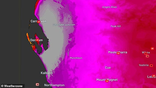
Parts of WA were the hottest place on Earth this weekend (pictured) with temperatures reaching almost 50 degrees Celsius
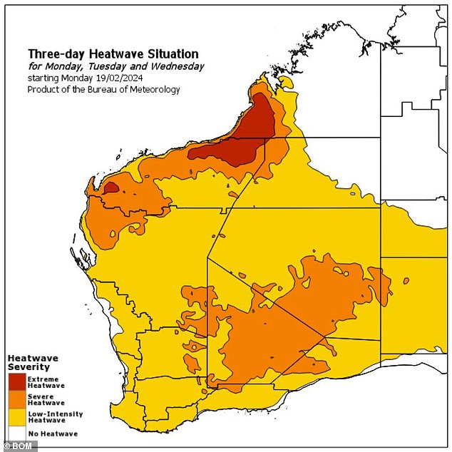
The central, western and southern parts of WA are in the grip of a severe heatwave expected to last until Wednesday
Canberra
A partly cloudy day with a high chance of showers is expected in the national capital for most of Monday.
The wet weather is likely to continue until Thursday with highs of 27 degrees on Wednesday.
A cool and mainly dry weekend is forecast.
Adelaide
Temperatures will reach a high of 35 degrees Celsius on Monday and Tuesday before a cool change arrives.
The warm weather will turn cooler from Thursday and the weekend is expected to be mainly dry.

Parts of the east coast are experiencing uncertain weather conditions with a mix of warm and dry weather (beachgoers in the photo)
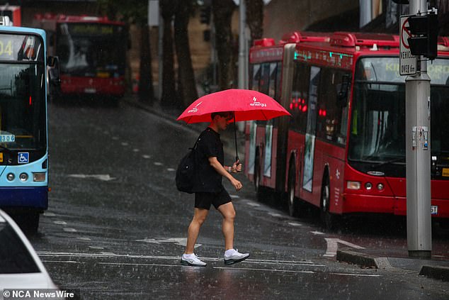
The warm weather is also interrupted by rain and thunderstorms (photo)
Hobart
A cloudy day is expected for Hobart on Tuesday and Wednesday, before temperatures rise with highs of 33 degrees Celsius on Thursday.
A cooler change is expected late Thursday, with gusts of up to 22 mph expected on Friday.
The weekend will be mainly dry.
Darwin
Mr Dutschke said Darwin was in for a mostly dry week, but chances of showers and thunderstorms were forecast for each day.
Highs of 32 are expected on Monday, with Friday set to be the hottest day this week with temperatures reaching a maximum of 33 degrees.
“The monsoon that has been happening over the Top End is getting weaker,” Mr Dutschke said.
“(It will be) a little warmer than normal for this time of year.”
A watch and act alert has been issued for parts of the Northern Territory as ex-tropical Cyclone Lincoln, currently near Tennant Creek, moves south-west.
Parts of the Stuart Highway were closed to motorists due to flooding, with motorists urged to avoid the area.
The Gregory, North Tanami and Barkly regions could face the threat of flash flooding, with a total of up to 150mm of rainfall expected every six hours.
