Wild storms and severe floods to batter Australia while millions brace for scorching heatwave – what the forecast looks like near you
- Monsoon causes flash floods
- Heat wave also affects other parts of Australia
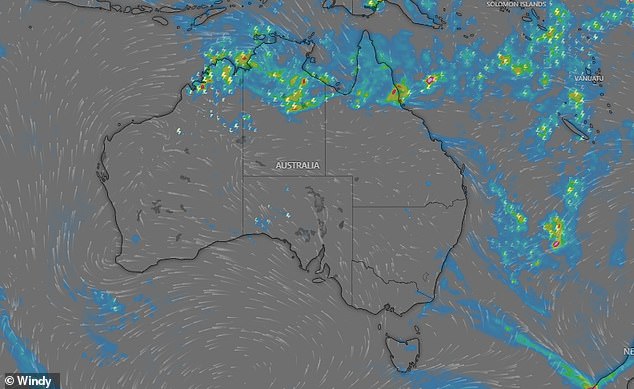
Queenslanders have been warned to prepare for the possibility of flash flooding as a monsoon trough sweeps across the state’s far north, bringing another wave of heavy rain to already soaked ground.
The Bureau of Meteorology warned that already flood-hit areas in the state’s north could be hit with further daily totals of between 50 and 100mm, with the monsoon trough likely to cause further weather chaos later this week.
“More widespread heavy rainfall is likely to develop later this weekend as the monsoon strengthens,” the BoM warned.
‘Significant rises in rivers, creeks and streams are likely amid heavy rainfall, with minor to major flooding possible in the Flood Watch area over the next week.’
Queenslanders have been warned to prepare for the possibility of flash flooding as a monsoon trough sweeps across the state’s far north, bringing another wave of heavy rain to already soaked ground

The Bureau of Meteorology warned that already flood-hit areas in the state’s north could be hit with further daily totals of between 50 and 100mm, with the monsoon trough likely to cause further weather chaos later this week
A flood watch has also been imposed in the north-west of the Northern Territory as there are fears catchments could be quickly overrun, with more heavy rain forecast later this week.
Although the trough is not expected to develop into a tropical cyclone, daily rainfall of 50 to 150 mm, plus isolated heavier rainfall, could lead to major flooding in the coming days.
A low pressure system is expected to develop southwest of Darwin throughout Sunday, bringing storms, heavy rain and wind.
The Bureau warned that ‘many roads, and possibly primary and secondary highways, could be affected’, with some communities and farms at risk of becoming isolated due to rising water levels.
Residents have been urged to check road conditions before traveling and never drive into floodwaters.
Meanwhile, inland South Australia and Western Australia have been urged to brace for a heatwave.

A flood watch has also been imposed in the north-west of the Northern Territory as there are fears catchments could be quickly overrun, with more heavy rain forecast later this week.
In Western Australia, highs could reach the mid-40s in the north of the state, and the mid-30s in the far south.
Severe heatwaves are expected to occur over the next week, with major areas of concern including the Perth metro area, as well as Bunbury, Katanning, Meekatharra, Mount Magnet, Manjimup, Margaret River, Narrogin, Northam and Paraburdoo.
A severe heatwave warning is also in effect for South Australia’s North West Pastoral District. Temperatures could rise into the 40s in the APY Lands and Oak Valley, with warm conditions expected to continue through Monday.
